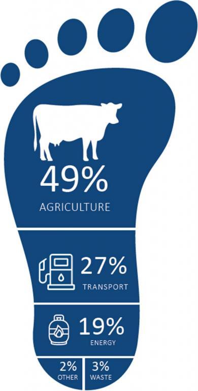
Bay of Plenty Regional Council has commissioned community carbon footprints for the Bay of Plenty Region for the 2015/16 and 2020/21 financial years. These carbon footprints provide information about the Whakatāne District's emissions, helping us understand how much greenhouse gas emissions our district discharges into the atmosphere, and where these come from. It is a first step to understanding what actions we could take to reduce the emissions that contribute to climate change. It will allow us to monitor change and help quantify the benefits of any action we take as a district.
AECOM New Zealand were commissioned for this work. The footprint followed a globally recognised methodology, which is used by cities around the world (the Global Protocol for Community Scale Greenhouse Gas Emissions Inventory).
The report shows the greenhouse gas emissions for the Whakatāne District.
- 2021/22 Whakatāne District Community Carbon Footprint - (PDF, 1.6 MB)
- 2021/22 Bay of Plenty Region Community Carbon Footprint - (PDF, 1.5 MB)
- 2015/16 Whakatāne District Community Footprint Report - (PDF, 3 MB)
Whakatāne District Emissions
Gross carbon footprint - 1,103,952 (tCO2e*) 2021

*Tonnes of carbon dioxide equivalent
